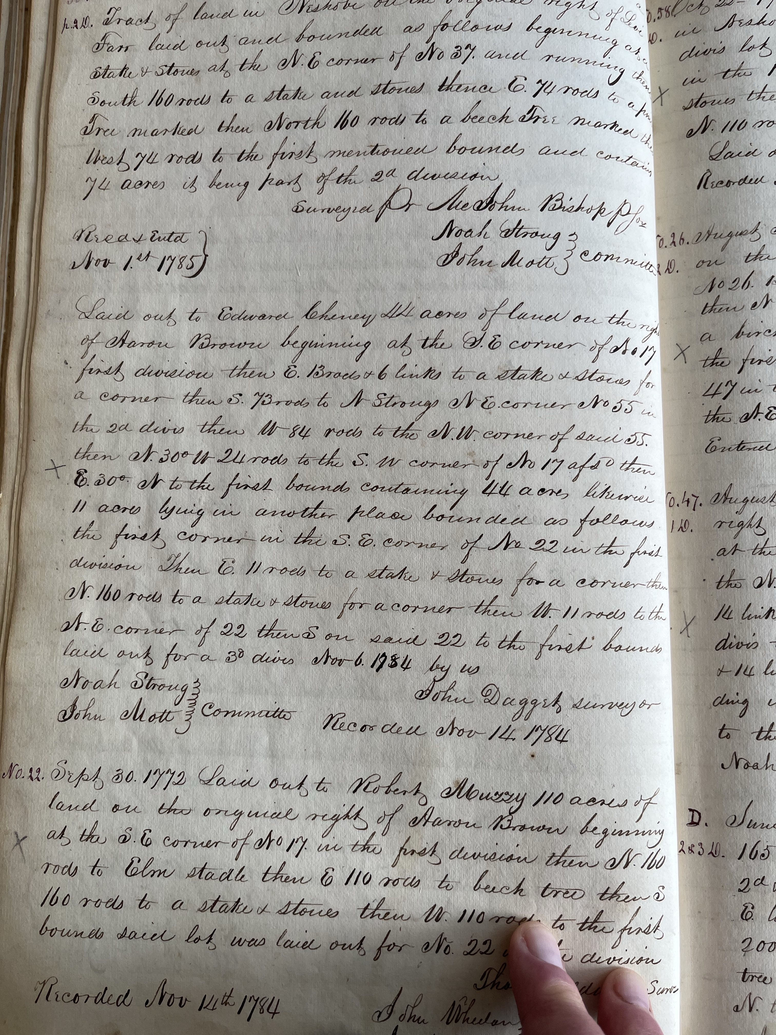
From Brandon Survey Book.
Laid out to Edward Cheney 44 acres of land on the right of Aaron Brown beginning at the SE corner of No 17 first division then E 13 rods and 6 links to a stake & stones for a corner then S 73 rods to N Strongs NE corner No55 in the 2nd Divis then W 84 rods to the NW corner of said 55. then N 30 degrees W 24 rods to the SW corner of No 17 aforesaid then E 30 degrees N to the first bounds containing 44 acres likewise 11 acres lying in another place bounded as follows the first corner in the SE corner of No 22 in the first division Then E 11 rods to a stake & stones for a corner then N 160 rods to a stake & stones for a corner then W 11 rods to the NE corner of 22 then South on said 22nd to the first bounds laid out for a 3d divis November 6 1784 by us
Noah Strong }
John Mott} Committee
John Daggert, Surveyor
Recorded November 14th 1784